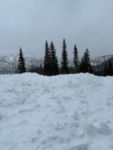
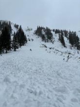
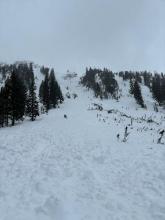
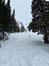
All Avalanche Incidents for Advisory Year 2023-24
Caught: 0 ; Buried: 0
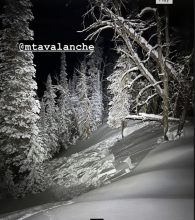
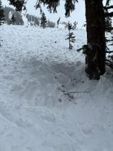
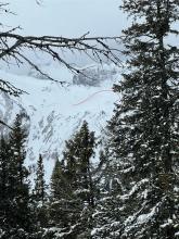
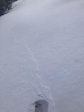
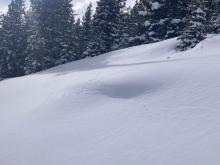
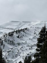
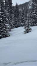
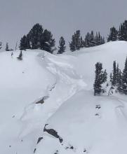
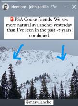
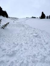
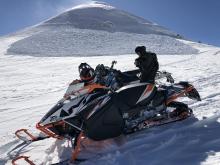
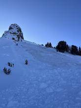
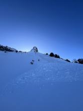
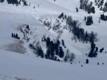
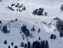
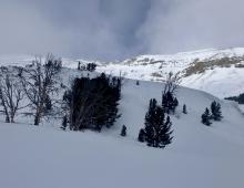
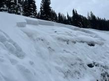
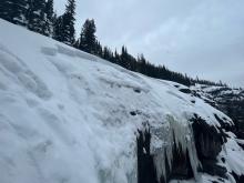
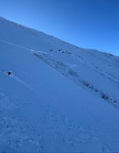
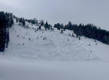
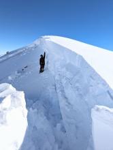
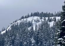
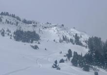
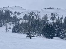
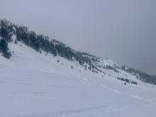
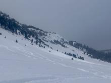
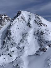
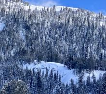
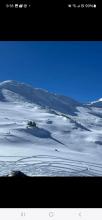
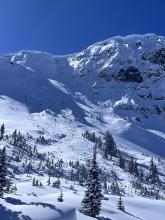
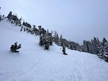
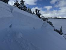
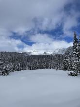
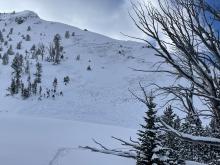
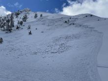
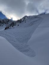
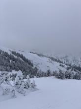
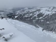
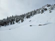
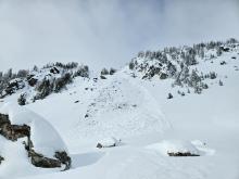
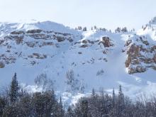
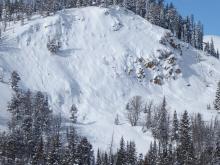
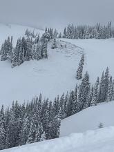
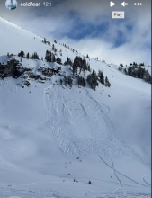
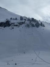
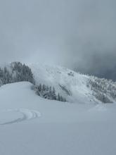
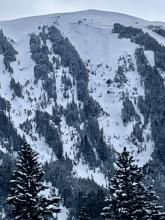
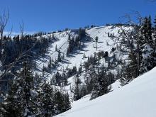
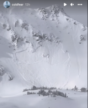
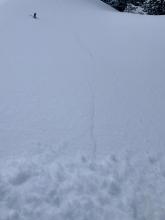
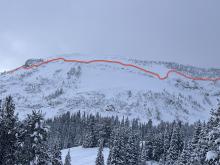
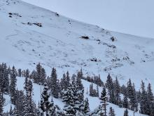
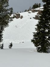
Photo from IG, slide occurred night of 3/1.
More Avalanche Details
N
Coordinates: 45.4472, -110.9620
Caught: 0 ; Buried: 0
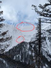
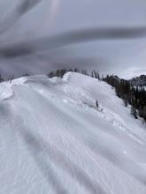
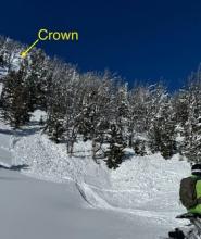
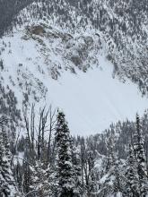
Riders in Hyalite saw an avalanche on an east-facing slope near Maid of the Mist. This likely happened between 02/29/2024- 03/01/2024.
More Avalanche Details
HS-N-R2-D2
Elevation: 10,000
Aspect: NE
Coordinates: 44.9041, -111.1850
Caught: 0 ; Buried: 0
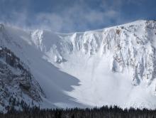
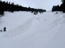
We rode into Tepee Basin and saw two recent avalanches. this one looked like it maybe happened yesterday, on a heavily wind-loaded slope below some cornices, 2-2.5' deep and 250-300' wide.
More Avalanche Details
SS-R3-D2-O
Aspect: E
Coordinates: 44.7145, -111.3180
Caught: 0 ; Buried: 0
From a phone call:
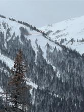
A rider saw a large avalanche in one of the bowls around the corner of Lionhead avalanched. It likely occurred on Friday, March 1. There were holes dug in the snow indicating a buried person or sled. This is the same slope that killed a 19 year old from MN on December 28, 2006. They conducted a beacon search on the debris to make sure no one was buried.
More Avalanche Details
SS-AMu-R2-D2-O
Coordinates: 44.7536, -111.3300
Caught: 0 ; Buried: 0
From a phone call:
A rider was traversing a slope when he triggered and was caught in a slide. He was partially buried under his sled and was uninjured. He estimated the slide to be 150 yards wide and a few feet deep and breaking to the ground.
More Avalanche Details
Coordinates: 45.4444, -111.0040
Caught: 0 ; Buried: 0
Skiers at Mt. Blackmore on 03/01/2024 saw numerous loose snow avalanches.
More Avalanche Details
SS-N-R2-D1-I
Coordinates: 45.8958, -110.9680
Caught: 0 ; Buried: 0
Riders on 03/01/2024 saw 2 fresh natural avalanches below the saddle between Naya Nuki and Sacajewea.
More Avalanche Details
L-N
Coordinates: 45.9151, -110.9810
Caught: 0 ; Buried: 0
Riders on 03/01/2024 noticed several loose snow avalanches on steep terrain below Hardscrabble Peak.
More Avalanche Details
Coordinates: 44.9609, -111.1000
Caught: 0 ; Buried: 0
From obs: "While touring in the Bacon Rind area today, our group experienced three audible collapses, one of which was extremely large and thundering. All of these collapses were experienced in the flat meadow areas below the typically skied slopes. "
More Avalanche Details
N-D1.5
Coordinates: 45.3934, -110.9690
Caught: 0 ; Buried: 0
From obs on 03/01/2024: "Looking out towards Divide Peak and the Divide Cirque at the end of the day, we noted 3 fresh crowns that were not present in the morning. These were D1 to D1.5 in size, breaking along the base of cliffs, and appeared to be wind slab avalanches from a brief peek through some glass. There was a lot of small loose dry activity that we observed across canyon at middle to upper elevations as you would expect with strong winds and fresh snow. All activity was in line with what one would expect given the forecast and weather inputs. "
More Avalanche Details
Skiers on 02/28/2024 experienced widespread collapsing while in the Mosier Creek drainage in Hyalite.
More Avalanche Details
N-R2-D1.5-I
Coordinates: 44.9855, -109.9410
Caught: 0 ; Buried: 0
From obs on 02/29/2024: "observed 2 crowns in wind loaded terrain. One at the end of Woody ridge on a north facing sub ridge (Peterson’s prow ) and the other on an East facing Ridge seen from the top of Wyoming bowl. "
More Avalanche Details
Coordinates: 45.4472, -110.9620
Caught: 0 ; Buried: 0
Skiing some dog pow across Hyalite reservoir between 7200-7800’ on a NE pitch I got lots of whumphs and shooting cracks while braking trail. This was a shallower snowpack than most other areas, it was still easy to break into basil facets with skis on.
More Avalanche Details
HS-N-R1-D1
Coordinates: 45.7943, -110.9360
Caught: 0 ; Buried: 0
From obs: "I was skiing inbound at Bridger Bowl today and noticed a small wind slab avalanche that failed on quarter saddle. I estimate comparing the photo to Google Earth that the slide ran 250 vertical feet and broke 100+ feet wide. Ongoing wind-loading and obvious instability. "
More Avalanche Details
SS-N-R1-D2-O
Aspect: NE
Coordinates: 45.4477, -110.9890
Caught: 0 ; Buried: 0
From IG: This avalanche was from this morning (02/28). It was windy and the gully was likely wind-loaded. One video shows the debris and crown. The pin on the map (below) shows the location of the debris.
More Avalanche Details
SS-N
Aspect: E
Coordinates: 44.7145, -111.3180
Caught: 0 ; Buried: 0
On 02/29/2024: From the parking lot near Hebgin Lake, we were able to see several natural avalanches that happened on Lionhead Ridge. These avalanches all occurred in a similar timeframe to each other. While riding below Lionhead Ridge we observed another avalanche that likely happened a few days prior near 02/27/2024.
More Avalanche Details
SS-N-R1-D1-I
Elevation: 9,100
Aspect: N
Coordinates: 45.0607, -111.2720
Caught: 0 ; Buried: 0
We noted a relatively small storm slab avalanche the failed on the wall of Sage Basin.
More Avalanche Details
N
Coordinates: 45.0202, -109.9380
Caught: 0 ; Buried: 0
From email: "We didn't see any avalanches on E Henderson or E Sheep with decent vis on the ride in. One large avalanche on a heavily wind loaded slope below a huge cornice north of Scotch Bonnet. That one looked like it broke deeper/in the old snow, about 100' wide. Also saw one wind slab on a small slope north of Long Lake. 14-16" deep, 20' wide, and within the fresh wind slab. "
More Avalanche Details
Coordinates: 45.2694, -111.1400
Caught: 0 ; Buried: 0
Riders on 02/29/2024 observed a small avalanche while riding in Portal Creek. They estimated that the avalanche likely happened before a storm that began on 02/27/2024.
More Avalanche Details
N-R2-D2-O
Aspect: N
Coordinates: 45.0423, -109.9650
Caught: 0 ; Buried: 0
From IG message: “These are on the ridge between Miller Mtn and Sunset Peak on North aspect. All of the North facing ridge of Miller Creek up to Miller Mountain had similar slides too. The crowns filled back in overnight… The North facing ridge on Sheep Mtn slid as well, not sure on the trigger but a rider from another group send the following image of the Sheep slide“
More Avalanche Details
SS-ASc-R1-D1-I
Aspect: E
Coordinates: 45.3242, -111.3820
Caught: 0 ; Buried: 0
Skiers intentionally triggered a wind-slab avalanche at the cornice near the prayer flags in Bear Basin. Strong winds have drifted snow for the last two days.
More Avalanche Details
HS-AS-R1-D1-I
Elevation: 9,900
Aspect: W
Coordinates: 44.9739, -109.9240
Caught: 0 ; Buried: 0
From Obs: "Toured up the west side of Woody via Central Park approach. Moderate to high wind gusts at the ridge line. Skied a couple laps in variable conditions on Sub bowl and then returned to the West aspect for a lap down South Central .
Traversed into the tube at tree-line roughly 9900’ and triggered a small wind slab. Crown was around ~1 foot deep and maybe 40 feet wide. Possibly stepped down a bit once in the tube and then ran for about 300 feet.
HS-AS-D1-R1"
More Avalanche Details
N-R3-D3-O
Aspect: NE
Coordinates: 45.2981, -111.5240
Caught: 0 ; Buried: 0
This avalanche likely happened in the last 24 hours following a large increase in windspeed beginning early in the morning on 02/24/2024.
From obs: "Large slide in the north basin of Fan Mountain. The flies is below the north, northeast couloir and the crown runs all the way around the basin. It went to the ground below the couloir and a few other places. 10ft crown probably at the biggest point below the couloir. "
More Avalanche Details
SS-N-R3-D3-O
Aspect: W
Coordinates: 44.7286, -111.3290
Caught: 0 ; Buried: 0
A rider reported a large avalanche in Targhee Creek that likely broke on Feb 23. He estimated the slide broke 1000' wide, 3-4' deep and ran 650' vertical.
More Avalanche Details
N
Elevation: 9,400
Aspect: NE
Coordinates: 45.1727, -111.4480
Caught: 0 ; Buried: 0
From obs 2/24/24: "Saw multiple large slides around the McAtte drainage N/NE aspects. Some were larger than others but all ran on what looked like a persistent grain or even to the ground in some. Probably natural released over last few days."
More Avalanche Details
HS-R3-D2-O
Elevation: 10,000
Aspect: N
Coordinates: 45.0785, -109.9370
Caught: 0 ; Buried: 0
On 2/24/24 We saw a slide on the north end of Sheep Mtn. on a slope above the steep chute where people climb out of Goose Creek (photos attached). This slide had not been reported previously and looked similar in age to the two triggered yesterday, so maybe broke naturally or human-triggered in last 24 hours. It broke near a scoured north facing ridgeline, 1-1.5' deep, 175' wide. HS-R3-D2-O.
More Avalanche Details
HS-AMu-R3-D3-O
Elevation: 10,200
Coordinates: 45.0709, -109.9580
Caught: 1 ; Buried: 0
A rider on 02/23/2024 triggered a large avalanche on the north side of Fisher Mountain near Lulu Pass. He was caught and carried downhill but luckily was not buried or injured. On the east side of the mountain, another avalanche was observed by the party and likely happened at the same time. This avalanche either happened sympathetically from the large slide or was remotely triggered by the rider.
More Avalanche Details
HS-AMr-R2-D2-O
Elevation: 9,600
Aspect: NE
Coordinates: 45.1749, -111.4460
Caught: 0 ; Buried: 0
From obs: "North facing aspect above McAtee creek. Triggered one remotely while traversing below, ~150 yards away, and likely triggered the second one from below as well but cannot confirm. 4-6 foot crowns, 50-100 yards wide, ran 75-100 yards"
More Avalanche Details
Caught: 0 ; Buried: 0
Wide collapses and cracks reported near Palisades Falls above the east fork Hyalite road.
More Avalanche Details
Elevation: 9,000
Aspect: N
Coordinates: 45.5289, -112.0180
Caught: 0 ; Buried: 0
Skiers on 02/21/2024 saw the crown of a few natural avalanches on a north-facing slope. While the exact timeframe these avalanches occurred is unknown they likely happened sometime near the end of last week.
More Avalanche Details
Aspect: W
Coordinates: 44.9837, -109.9580
Caught: 0 ; Buried: 0
From obs: "My ski partner triggered a big collapse/woomph from the our skin track, heading up from WY Creek back toward Republic Creek on an W facing slope. It was the second time we worked over this skin track, and it propagated to where I was at least, about 30 yards above them. I felt/heard the collapse 1/2 to 1 second after they triggered it."
More Avalanche Details
HS-ASr-R3-D2-O
Elevation: 9,100
Aspect: NE
Coordinates: 45.4623, -112.9610
Caught: 0 ; Buried: 0
From obs: "Accessed low angle settled powder runs via mellow ridge terrain adjacent to a known avalanche path which is steep, rocky and windloaded. We descended on lower angle terrain following uptrack. On second lap observed the crown and debris while climbing uptrack and suspected we remote triggered; it was not there on first lap. Slope angle 35-38 degrees estimated. Estimate crown depth 60-120 cms. Estimated debris depth 2-3 meters due to terrain trap of an abrupt transition to flat terrain at bottom of path. We did not approach the crown or debris due to hangfire. Starting Zone NE facing at 9100' on wind loaded convexity with unsupported terrain below and rocky bed surface and exposed rocks/cliffs. I would classify it as HS-ASur-R4-D2.5-O
Large collapses with cracks connecting weak spots in the snowpack for 50 feet around us while breaking trail. Slab has gotten quite a bit thicker and more cohesive with 3 inches SWE in past 14 days combined with relatively warm temps promoting settling, strong solar input on the southerlies, and some wind. Average snow depth 100 cms consisting of a F-1Fslab on top of 20-30 cms of large facets. A crust in between on solar aspects. There is a density break/layer of NSF in the slab you can see in some of the photos where it appeared to shear between those layers. A very scary snowpack even for the Pioneers which regularly harbor PWLs throughout the season."
More Avalanche Details
Coordinates: 44.9739, -109.9240
Caught: 0 ; Buried: 0
Close to the ridge and the starting zones of nearby avalanche paths, we triggered a large collapse that sent shooting cracks out a couple hundred feet. If the slope had been any steeper, we would have triggered an avalanche.
More Avalanche Details
Coordinates: 44.9041, -111.1850
Caught: 0 ; Buried: 0
Nothing new, but we were in Tepee Creek today. Three of us dropped into a flat meadow on a (wide) ledge, and after sitting there for a minute or less, we all felt a "whump" and collapse. While the meadow had some small rolling terrain, it was flat overall.
More Avalanche Details
Coordinates: 44.9609, -111.1000
Caught: 0 ; Buried: 0
From obs: "the snow is still bad! We were on top of bacon rind in the YNP, and dug a pit for fun and education of one of our party members. Experienced some BIG whoomphs on the way up and got very unstable scores. A Q2 CT19 and ECTP24, both around 85cm down into the snow pack (on the top of the very faceted layer we're seeing all over the advisory area."
More Avalanche Details
Coordinates: 45.0303, -109.9980
Caught: 0 ; Buried: 0
From obs: "While transitioning at the top of mineral mountain burn, a member of our party stepped away from our packed out transition spot and likely the deeper impact from his ski boots triggered the weak layer beneath us and created a massive whumf that propagated hundreds of feet and was strong enough to knock snow off of nearby trees. Nothing we observed slid but the collapse was extremely evident."
More Avalanche Details
HS-N-R1-D2-O
Elevation: 8,500
Aspect: NE
Coordinates: 45.7869, -110.9350
Caught: 0 ; Buried: 0
Skiers saw a recent avalanche in Argentina Bowl on 2/20. This avalanche probably happened in the last 48-72 hours.
More Avalanche Details
N-R3-D2.5-O
Elevation: 8,500
Aspect: NE
Coordinates: 45.7700, -110.9390
Caught: 0 ; Buried: 0
From obs 2/20/24: "On the drive up Bridger canyon this morning we noticed an avalanche on an east-northeast facing slope at the ridge near Bridger peak that was not previously noted or reported. Likely natural, possibly happened overnight or yesterday, but maybe earlier and went unnoticed? It looked 1-2’ deep with rocks showing through parts of the bed surface.... Debris did not appear to make it all the way down the chute to flatter runout. But, light was not great and all dimensions were difficult to confirm."
On 2/21 we drove up to look at the slide through binoculars. The slide broke full width of the starting zone and obviously ran to the bottom of the path, although the debris was not visible. Measured on gps, the slide is 300-450' wide
Slide was noticed by a member of BBSP on Monday 2/19, and likely happened on 2/18 or late 2/17.
More Avalanche Details
Caught: 0 ; Buried: 0
From obs: "Several naturals observed from the past few days. Large collapse on a NE 25 degree slope"
More Avalanche Details
N-R1-D1-O
Coordinates: 44.9205, -111.2300
Caught: 0 ; Buried: 0
From IG: 2 avalanches from either this morning or yesterday at the bottom of Skyline ridge 2’ at the crown
More Avalanche Details
Coordinates: 45.3407, -111.3910
Caught: 0 ; Buried: 0
From obs: "Widespread stubborn collapsing, often triggered by 3 or 4 person on the slope"
Several very small natural loose snow avalanches were also observed.
More Avalanche Details
Coordinates: 45.0254, -110.0310
Caught: 0 ; Buried: 0
From obs: "Went touring up Pebble Creek today and got multiple whumpfs/large collapses when stepping off the skin track."
More Avalanche Details
HS-AMr-R3-D2-O
Elevation: 9,200
Aspect: E
Coordinates: 45.1719, -111.3800
Caught: 0 ; Buried: 0
On 2/18/24 We saw a fresh avalanche that we either triggered from 750-800 feet away or it broke naturally. This avalanche happened when we were riding near the larger of the two avalanches from yesterday, on the south side of Cedar Mtn. When we regrouped at the base of the recent avalanche I was scanning all the nearby slopes and did not see any fresh avalanches, and noted a huge cornice on a low convex slope. We then rode up and parked near the top of yesterday's slide, and Doug noticed a fresh slide on the slope I had just been starring at. It was a wind-loaded slope, actively loading. The avalanche was ~130' wide with 100' of 4-12" deep new snow/wind slab, and 30' wide broke almost 3 feet deep on weak snow near the ground.
More Avalanche Details
N
Coordinates: 45.4029, -110.9760
Caught: 0 ; Buried: 0
From observations on 02/22/2024: "We toured to the east shoulder of Divide Peak today, 02/22/2024. We saw several natural avalanches on the north-facing terrain in Divide Cirque, below Hyalite Peak, and Overlook Mountain. These avalanches likely happened following a storm near the end of last week."
More Avalanche Details
N
Coordinates: 45.4156, -110.9970
Caught: 0 ; Buried: 0
From obs: "From the approach trail to Mummy II we saw two large crowns on the ridge associated with Mt. Bole. Not sure when they happened, but they looked pretty big! Observed Monday morning, February 19"
More Avalanche Details
AMr
Coordinates: 45.0661, -109.9590
Caught: 0 ; Buried: 0
Riders triggered an avalanche near fisher peak on 02/17/2024. Reported on 02/18/2024
More Avalanche Details
AMr
Coordinates: 45.0525, -109.9620
Caught: 0 ; Buried: 0
Riders triggered an avalanche remotely on Crown Butte. Reported on 02/18/2024
More Avalanche Details
Coordinates: 45.4472, -110.9620
Caught: 0 ; Buried: 0
From email: "My partner and I were out ice climbing in Hyalite today and I wanted to share our observations.
Our objective was Cleopatra’s needle. We arrived at the base of the climb around 11:30, skies were clear and winds were calm. Once I topped out around 3:30pm, skies were overcast and winds were picking up from the northwest and began to transport snow off the trees. I also noticed a pretty sizable crown on one of the convexities above Twin Falls. I traversed around to get a better look and took a couple pictures.
The crown appeared very new, likely within the past couple of days I would guess. It appeared 3 feet at its deepest and roughly 100 feet wide. I’m not sure if it was a natural or remote trigger, but definitely a scare nonetheless for any potential climbers below."
More Avalanche Details
Aspect: E
Coordinates: 44.9748, -109.9650
Caught: 0 ; Buried: 0
From obs on 02/17/2024: "From woody ridge, we observed a large avalanche across the republic creek drainage (not sure what the peak is called but see the coordinates). I heard it first since it sounded like thunder or a plane, and then saw a huge cloud of snow moving down the mountain across the drainage. We do not know if it was natural or triggered by someone.
We also observed large collapsing and whumpfing at the top of woody ridge on wind loaded slopes. Nothing moved as it was less than 30 degrees. "
More Avalanche Details
HS-ASu-R3-D2.5-O
Elevation: 10,200
Aspect: NW
Coordinates: 45.2771, -111.4640
Caught: 0 ; Buried: 0
From BSSP on 2/17/24: "Midafternoon we received another report of a skier triggered avalanche in the Lone Lake Circe, specifically The Mullet. The reporting party contacted several ski patrollers via cell phone and confirmed that nobody was injured or had taken the full ride. This avalanche failed near the ground on a high elevation NW facing slope with the weight of a single skier with an estimated size of HS-ASu-R3-D2.5-O."
More Avalanche Details
AMu-R3-D2-O
Elevation: 9,000
Aspect: N
Coordinates: 44.9680, -111.2870
Caught: 1 ; Buried: 1
From obs 2/17/24: "North facing slope partially treelined, not heavily windloaded. Rider triggered, Ran 100yards downhill with large debris through trees, broke 2-3' deep at the crown sliding on near earth facets. 1 rider partially caught, airbag deployed, self-extracted with no injuries."
More Avalanche Details
N-R3-D2
Aspect: S
Coordinates: 44.9041, -111.1850
Caught: 0 ; Buried: 0
From FB 02/17/24: "Observed runout debris from a small avalanche on a south facing forested slope in Upper Tepee Basin. Shows avalanches can occur through forested areas."
More Avalanche Details
N-R3-D2.5-O
Elevation: 9,800
Aspect: NW
Coordinates: 45.1760, -111.4590
Caught: 0 ; Buried: 0
Lots of natural activity up buck ridge. The one photoed looked like it popped off this morning. Most activity we saw seemed to be on northern facing aspects
More Avalanche Details
SS-AMr-R2-D1.5-O
Coordinates: 45.0607, -111.2720
Caught: 0 ; Buried: 0
From obs: "We observed another, probably rider triggered avalanche in Wapiti Creek that broke on old snow near the ground ~2 feet deep and ~60ft across."
More Avalanche Details
HS-AMr-R3-D2.5-O
Elevation: 9,200
Aspect: N
Coordinates: 45.2268, -111.5120
Caught: 0 ; Buried: 0
From IG 2/17: “Out on the cedar/ bear creek wilderness line. 10-12'x200' and probably 4-6'x400' on the one in the trees. Both remote triggered. We watched em both come down.”
More Avalanche Details
HS-AMr-R4-D3-O
Elevation: 9,500
Aspect: NE
Coordinates: 45.2268, -111.5120
Caught: 0 ; Buried: 0
From IG 2/17: “Out on the cedar/ bear creek wilderness line. 12'x200' and probably 6'x400' on the one in the trees. Both remote triggered. We watched em both come down.”
More Avalanche Details
Coordinates: 45.0298, -109.9690
Caught: 0 ; Buried: 0
From obs: "Probably heard the largest whumph i ever personally heard while skiing near the ridge on the Burn at Sheep Creek. Other groups also reported hearing whumphs too. While skinning out of sheep on a southern aspect we started seeing signs of warming with little pinwheels but none grew big and none were natural."
From another group: "...A few whomps were heard/felt skiing without any propagation or slides on the slope we skied...
we did talk to the group of 3/4. Earlier in the day, they had skinned further up the drainage and climbed up a west facing rib of Miller proper. On the first steeper slope while skinning up they experienced large snow settling and bailed."
More Avalanche Details
R2-D1.5
Elevation: 8,900
Aspect: NE
Coordinates: 44.9609, -111.1000
Caught: 0 ; Buried: 0
From obs on 2/20: "The skillet slid sometime recently. Based on the snow on top I'm guessing Thursday-Friday last week (Feb 15-16th), but it could have happened up to a week earlier. Broke ~2 ft deep, 150 ft wide, and it was hard to tell how far it ran, but I'm estimating 200 vertical feet."
More Avalanche Details
AM
Coordinates: 45.0733, -109.9480
Caught: 0 ; Buried: 0
A rider triggered a small avalanche on a steep rollover. This avalanche was below a much bigger avalanche the was triggered on 02/16/2024.
More Avalanche Details
HS-N-R2-D2-O
Elevation: 9,300
Aspect: NE
Coordinates: 45.1719, -111.3800
Caught: 0 ; Buried: 0
On 2/18/24 we rode out Buck Ridge to Muddy Creek and towards Cedar Mtn.. In addition to three previously reported avalanches, we saw at least eight recent avalanches that were not previously reported and appeared to have occurred at various times over the last 1-3 days, natural and/or remote triggered by riders. A group in the parking lot mentioned seeing many slides actively happen in this area on Friday 2/16, We saw at least six recent slides in Muddy Creek, two in McAtee Basin, and one in Second Yellow Mule. Most were 2-3' deep hard slabs, ranging from 50'-500' wide.
More Avalanche Details
HS-AMr-R3-D2.5-O
Elevation: 9,300
Aspect: N
Coordinates: 45.1719, -111.3800
Caught: 0 ; Buried: 0
On 2/18/24 we rode out Buck Ridge to Muddy Creek and towards Cedar Mtn.. In addition to three previously reported avalanches, we saw at least eight recent avalanches that were not previously reported and appeared to have occurred at various times over the last 1-3 days, natural and/or remote triggered by riders. A group in the parking lot mentioned seeing many slides actively happen in this area on Friday 2/16, We saw at least six recent slides in Muddy Creek, two in McAtee Basin, and one in Second Yellow Mule. Most were 2-3' deep hard slabs, ranging from 50'-500' wide.
More Avalanche Details
N
Aspect: SW
Coordinates: 45.0202, -109.9380
Caught: 0 ; Buried: 0
Skiers north of Cooke City saw a recent natural avalanche in steep terrain.
More Avalanche Details
AMu-D1.5
Coordinates: 45.0722, -109.9280
Caught: 0 ; Buried: 0
From email: "Was in round lake was visiting with a guy in the warm up shack. He said he caused a decent size avalanche on the sheep mountain side.
It was roughly 100 feet wide, he was hit by the avalanche but didn’t get buried."
More Avalanche Details
SS-AMr
Coordinates: 45.2890, -111.1410
Caught: 0 ; Buried: 0
From facebook on 2/16/24: "Rode up Portal creek today ... We triggered 4 avalanches with the farthest one being 300 yards away. The one in the photo was the scariest one. We were playing below the windy pass hillclimb and the chute next to it let go. We had a sledder almost get caught in it, but thankfully everyone was ok. It's scary out there!"
More Avalanche Details
SS-N-R2-D2
Coordinates: 45.3453, -111.3750
Caught: 0 ; Buried: 0
From instagram on 2/16/24: "Just getting to the ridge by prayer flags in Beehive basin. 100 maybe 200 yards wide. Cracked all the way around the corner almost to a couple old tracks. Seemed to be a natural from last night or this morning."
More Avalanche Details
HS-AMr-R3-D2-O
Elevation: 8,900
Aspect: N
Coordinates: 44.7145, -111.3180
Caught: 0 ; Buried: 0
On 2/16/24 we saw a fresh avalanche in Watkins Creek that we think was triggered remotely during the day by a group riding in a flat meadow above, where we saw their tracks at least 150 feet away (photo). This slide was 2-3' deep and 100-150' feet wide, breaking on old sugary snow. HS-R3/4-D2-O. We rode along the flat terrain above the avalanche and could feel our sled tracks punch through the supportable slab into weak snow at the bottom of the snowpack.
We felt a couple collapses while sitting on our sleds, and saw a couple long shooting cracks while riding. We dug a snowpit in Targhee creek on a northwest facing slope at 9,435'. We had an ECTP27 below a 2.5' deep slab, sitting on 1.5' of weak sugary snow.
More Avalanche Details
SS-AM-R2-D2-O
Elevation: 10,000
Aspect: E
Coordinates: 45.0524, -109.9450
Caught: 0 ; Buried: 0
Snowmobilers observed an avalanche on the east side of Henderson Mountain that appeared to be rider triggered.
More Avalanche Details
SS-N-R2-D2-O
Elevation: 9,800
Aspect: N
Coordinates: 45.0497, -109.9640
Caught: 0 ; Buried: 0
A natural avalanche happened early in the morning on the north side of Chimney Rock near Daisy Pass.
More Avalanche Details
HS-AM-R3-D3-O
Elevation: 10,200
Aspect: N
Coordinates: 45.0735, -109.9450
Caught: 0 ; Buried: 0
A rider on 02/16/2024 triggered a large avalanche on the north side of Scotch Bonnet. Skiers nearby noted that they saw riders on and below the slope but did not see that avalanche happen.
More Avalanche Details
Coordinates: 45.8549, -110.9300
Caught: 0 ; Buried: 0
From obs: "Skiing / skinning on north facing areas above the Brackett Creek area with room many to remember big collapses sounding like distant thunder. One was large enough to shake snow off nearby trees. "
More Avalanche Details
Coordinates: 44.9609, -111.1000
Caught: 0 ; Buried: 0
Skiers in Bacon Rind heard a whumpf and saw cracking on the slope below.
More Avalanche Details
N
Coordinates: 44.9713, -111.0970
Caught: 0 ; Buried: 0
Skiers on 02/22/2024 observed an old avalanche that appeared to of been natural that happened sometime last week near 02/15 -02/16.
More Avalanche Details
N
Aspect: E
Coordinates: 45.0202, -109.9380
Caught: 0 ; Buried: 0
From email: "Noted several 1-2 day old dry loose in steep terrain above the cliffs to the lookers left of Hang Ten. Also A large avalanche. crown propogated through the cliffs and looked to be about 200' wide and 1 1/2-2 ft. deep. Debris was no longer visible so I suspect this ran sometime during or shortly after the storm. (02/15)."
More Avalanche Details
Aspect: NE
Coordinates: 45.4321, -110.9420
Caught: 0 ; Buried: 0
From obs on 02/18/2024: "Toured up to Flanders today. Variable snow but stable conditions on the main route to the SE Bowl. Large natural avalanche on the NE face south of Flanders."
More Avalanche Details
N
Elevation: 9,000
Aspect: NW
Coordinates: 45.0202, -109.9380
Caught: 0 ; Buried: 0
From email on 02/18/2024: "Photo natural avalanche on a NW aspect at 9000', taken north of Cooke City today. It likely happened right around Feb. 15th.
More Avalanche Details
SS-N-R2-D2-O
Coordinates: 45.0607, -111.2720
Caught: 0 ; Buried: 0
From Obs on 02/17/2024: "We observed large natural avalanches from afar on the west side of Snowslide Mountain, and the east aspect of a peak south of Woodward Mountain. We observed these from a few miles away and were probably several feet deep and a few hundred feet wide."
These avalanches likely happened during or near the end of a large storm that started on 02/14/2024.
More Avalanche Details
N-R2-D2-O
Elevation: 9,000
Coordinates: 44.7145, -111.3180
Caught: 0 ; Buried: 0
On 2/16/24 GNFAC forecasters rode up Denny Creek below Lionhead Ridge, then around to the north, through Watkins Creek and into the top of Targhee Creek. We saw a lot of old and recent avalanches that happened at various times over the last week, including during an avalanche warning on 2/15, in a wide variety of terrain. On lower elevation, generally non-wind-loaded terrain in the trees we saw at least 4 avalanches that were at least 2' deep and 100' wide. Near ridgelines there were many avalanches, harder slabs, at least 2' deep breaking hundreds of feet wide.
More Avalanche Details
SS-N-R2-D2-O
Elevation: 10,000
Aspect: E
Coordinates: 45.0202, -109.9380
Caught: 0 ; Buried: 0
Natural avalanches were observed on 02/16/2024 that happened either early in the morning on the 16th or the night before on the 15th.
More Avalanche Details
N-R3-D1.5-O
Elevation: 9,600
Aspect: N
Coordinates: 45.7648, -112.4860
Caught: 0 ; Buried: 0
From obs: "North facing, cross loaded, mid-mountain slope on an east to west running rib at around 9,600'. Typically this zone is scoured by W-SW winds. Mild to moderate winds and new snow of 10-12" sitting on an exceptionally weak base produced a natural release during the recent storm cycle, possibly early AM 2/15/24. The slide appeared to run full track, 800' +, taking out most of the north facing wall."
More Avalanche Details
AMr-R4-D2-O
Coordinates: 45.1857, -111.4250
Caught: 0 ; Buried: 0
From obs: "Towards the end of the day one of our riders remote triggered a massive avalanche on the North facing slope to the North of Yellow Mule cabin. The 3-4 ft crown propagated around 600 yards wide and slid on near ground facets to the bottom of the slope below depositing a very large debris pile well into the trees."
More Avalanche Details
L-N-R1-D1
Elevation: 8,500
Aspect: SW
Coordinates: 45.3453, -111.3750
Caught: 0 ; Buried: 0
We noted a small, natural avalanche across the valley in Bear Basin. It appeared to have failed within the storm snow as a loose snow avalanche.
More Avalanche Details
AMr-R1-D1
Coordinates: 45.0607, -111.2720
Caught: 0 ; Buried: 0
On 2/14/23 we saw a slide in Sage Basin that appears to have been remotely triggered by riders yesterday from ~100 ft away. Couldn't get a great view of it but it appeared to break in two pockets ~50 ft apart, each at least 25 ft wide and running 30 vertical feet.
More Avalanche Details
SS-AM-R2-D1.5-O
Elevation: 9,500
Aspect: NE
Coordinates: 45.1719, -111.3800
Caught: 0 ; Buried: 0
A small rider triggered avalanche at the top of Third Yellowmule.
More Avalanche Details
N
Aspect: W
Coordinates: 45.1771, -111.4350
Caught: 0 ; Buried: 0
Several natural avalanches in McAtee Basin. These avalanches happened early in the morning following a recent storm.
More Avalanche Details
SS-AMr-R2-D2-O
Elevation: 9,400
Aspect: N
Coordinates: 45.1719, -111.3800
Caught: 0 ; Buried: 0
We rode into Buck Ridge today and in First Yellow Mule, we triggered an avalanche 100' away from a flat meadow below. This avalanche broke several hundred feet wide and 3' deep on weak faceted snow low in the snowpack. This was right next to a slope that we had remotely triggered weeks ago on January 22nd, observation here.
More Avalanche Details
N
Coordinates: 45.3407, -111.3910
Caught: 0 ; Buried: 0
Skiers noted two natural avalanches on Beehive Peak.
More Avalanche Details
SS-AS-R2-D2-O
Coordinates: 45.2952, -111.4100
Caught: 0 ; Buried: 0
Skiers triggered an avalanche at the end of Forest Service Wall outside of Big Sky Resort boundary.
More Avalanche Details
Elevation: 7,000
Aspect: NE
Coordinates: 45.6019, -110.9650
Caught: 0 ; Buried: 0
From obs: "Got a whumph descending the ridge from little Ellis on the ENE facing slope just below the ridge around 7000'."
More Avalanche Details
Coordinates: 45.8822, -110.9520
Caught: 0 ; Buried: 0
On a wind-loaded slope skiers experienced a large collapse and saw shooting cracks above and below them. They also easily triggered small loose snow avalanches in the new snow.
More Avalanche Details
SS-N-R2-D2-O
Aspect: E
Coordinates: 45.0524, -109.9450
Caught: 0 ; Buried: 0
Avalanche on the east side of Henderson Mountain observed on 02/13/2024
More Avalanche Details
N
Aspect: N
Coordinates: 45.4402, -110.9310
Caught: 0 ; Buried: 0
From obs: "Skied the whitebark glade on Flanders and got several whumpfs at the mid and upper elevations. Light overnight and continued wind loading. There was a recent avalanche that appeared to be a wind slab with decent propogation on a north facing rocky slope. Visibility was too poor to get a good look or photo. "
More Avalanche Details
Coordinates: 44.9609, -111.1000
Caught: 0 ; Buried: 0
From obs: "We got the same feedback that Dave and Doug did on 2/5/24 - collapsing every time we stepped out of the skin track or turned with any force, as well as a few sizable collapses triggered from inside the skin track. Very touchy, skied very well. Stayed well away from avy terrain."
More Avalanche Details
SS-ASr-D2-O
Elevation: 9,900
Coordinates: 45.0722, -110.0220
Caught: 0 ; Buried: 0
Three avalanches were triggered 20-50' away from low-angel terrain above by skiers on Mt. Abundance.
From obs: "We observed three similar avalanches on Mt Abundance today (2/11). All were at about 9,900' and on NE-NW aspects. We were able to safely look at the crown of the first one, which was ~150' wide, 55cm deep, and with an HS of 145. It failed on 1-2 cm buried surface hoar. The other avalanches were on shallow unsupported rocky terrain. All were remote triggered from low angle terrain above, 20-50' away. One of the avalanches sympathetically released a gully and ran 800'."
More Avalanche Details
SS-ASr-R2-D2-O
Coordinates: 45.3374, -111.3810
Caught: 0 ; Buried: 0
Skiers in Middle Basin remotely triggered two avalanches while crossing below them. One was triggered by the party breaking trail, the second by a 2nd party from the skin track.
More Avalanche Details
Elevation: 8,200
Aspect: NE
Coordinates: 44.8381, -111.3430
Caught: 0 ; Buried: 0
A small whumpf in the skin track was followed by a massive one a few minutes later. I can count on one hand the number of times I got whumpfs in a skin track...rare indeed. The second one was so big it had us both deeply concerned. We peeled off the skin track after deciding to not cross a gully and soon found debris from a sizeable avalanche that released a couple days ago about 500' above us. We dug in the flank and had 100cm of snow, 60 cm new from last week. The snowfall during the Avalanche Warning, doubled the depth and more than doubled the snow water equivalent of the snowpack. It was a large load and avalanches are breaking underneath the new snow.
Karl was using his 100 cm long Norwegian Battle Saw (pic)...a bit overkill.
More Avalanche Details
N-R1-D2
Elevation: 8,600
Aspect: E
Coordinates: 45.7798, -110.9350
Caught: 0 ; Buried: 0
A Bridger Canyon commuter reported 3-4 fresh slides on Baldy and Saddle Peak
From BBSP 2/11/24: "there’s at least 3 slides from over night on the north side of the skyline, 1on the south edge of the football field and one higher on the upper rock band that ran over the cliffs into going home chute".
More Avalanche Details
HS-AMr-R3-D3-O
Coordinates: 45.6553, -110.5580
Caught: 0 ; Buried: 0
From FB message 2/11/24: "Picket Pin Mountain yesterday. We triggered it but weren't anywhere near it"
More Avalanche Details
N-R3-D2
Elevation: 9,100
Coordinates: 44.7145, -111.3180
Caught: 0 ; Buried: 0
On 2/16/24 We rode up Denny Creek below Lionhead Ridge, then around to the north, through Watkins Creek and into the top of Targhee Creek. We saw a lot of old and recent avalanches that happened at various times over the last week, and in a wide variety of terrain. On lower elevation, generally non-wind-loaded terrain in the trees we saw at least 4 avalanches that were at least 2' deep and over 100' wide. Near ridgelines there were many avalanches, harder slabs, 2' deep breaking hundreds of feet wide.
More Avalanche Details
SS-N-R2-D2
Coordinates: 45.0607, -111.2720
Caught: 0 ; Buried: 0
On 2/14/23 we saw two recent natural avalanches along the headwall of Sage Basin and one in Sunlight Basin. Date is estimated based on how much snow is on the debris. All of the slide looked to be 2-3 ft deep, breaking on the early season weak snow at the bottom of the pack. One of the slides in Sage broke ~700 ft wide.
More Avalanche Details
Coordinates: 45.1763, -111.3310
Caught: 0 ; Buried: 0
From obs: "When riding on test slopes with similar conditions we saw shooting cracks all around the sled. We broke a couple slabs on hills around 25degs right at the crest of the hill but only the crest broke or showed signs of instability."
More Avalanche Details
SS-N-R2-D2-O
Aspect: N
Coordinates: 44.5424, -111.7520
Caught: 0 ; Buried: 0
From obs. 2/11: "No details, came upon them while riding and making observations of the terrain. One was North-Northeast, the other was North-Northwest facing. Across the drainage from each other. Also, notice three other small avalanches on a west facing slope, about two miles east of the first two. All five were on slopes well over 30. In the centennial mountains, close to the continental on the Idaho/Montana border."
More Avalanche Details
SS-N-R3-D2
Elevation: 8,900
Aspect: N
Coordinates: 45.0017, -109.9550
Caught: 0 ; Buried: 0
From email: "Natural avalanche from yesterday evening or last night.
North facing aspect, with an interesting 3 tiered crown beginning around 8900'."
More Avalanche Details
SS-N-R3-O
Elevation: 8,200
Aspect: NW
Coordinates: 45.5057, -110.4960
Caught: 0 ; Buried: 0
From IG message: “It looks like the lawn mower up north deep creek slide full path. Looking through Bino’s from the valley it looked fairly fresh. Multiple fracture lines up at the starting point. I assume it went naturally”
More Avalanche Details
SS-AMu-R2-D2-O
Elevation: 9,700
Aspect: N
Coordinates: 45.0525, -109.9620
Caught: 0 ; Buried: 0
A snowmobiler triggered an avalanche as she climbed up the backside of Crown Butte. As she descended the slope the avalanche broke and ran down the slope behind her. Thankfully, no one was caught or injured.
More Avalanche Details
N-R2-D2
Aspect: E
Coordinates: 44.5278, -111.5680
Caught: 0 ; Buried: 0
From IG 2/10/24: “East aspect, southwest of island park from the blue creek trailhead.”
More Avalanche Details
Coordinates: 44.8893, -111.2060
Caught: 0 ; Buried: 0
From Obs: "As we were coming out, I spotted this cracking above the creek. A sled has passed nearby on the right side ( you can see the track). The snow cracked and was starting to rub in the left (barely)."
More Avalanche Details
SS-AMu-R2-D2-O
Elevation: 8,200
Coordinates: 44.5490, -111.4750
Caught: 0 ; Buried: 0
A group of snowmobilers triggered an avalanche on a low-elevation slope in the Centennial Mountains as they rode near the bottom of a steep slope. No one was caught.
More Avalanche Details
SS-AMr-R3-D2.5-O
Aspect: E
Coordinates: 44.7145, -111.3180
Caught: 0 ; Buried: 0
A group of riders triggered a large avalanche on Lionhead Ridge as they traveled in nearby terrain that was much less steep.
More Avalanche Details
N-R2-D2-O
Elevation: 9,800
Aspect: W
Coordinates: 44.9739, -109.9240
Caught: 0 ; Buried: 0
A natural avalanche on Woody Ridge likely broke sometime between the afternoon 02/09/2024 and 02/10/2024. The reporting party skied in this region on 02/09 and did not see this avalanche. On 02/10 they reported continued collapsing and cracking as well.
More Avalanche Details
SS-AMr-D2-O
Elevation: 9,220
Aspect: N
Coordinates: 45.1719, -111.3800
Caught: 0 ; Buried: 0
From obs: "Member in our group was on the flank of the slope. Crack shot from beneath sled and triggered the slope from ~ 100’ away. Broke about 75 yards wide, ripped to dirt and travelled a short ways to toe of the slope. North facing, 9220’"
More Avalanche Details
SS-N-R2-D2-O
Elevation: 9,000
Aspect: E
Coordinates: 44.8381, -111.3430
Caught: 0 ; Buried: 0
Skiers near Hebgen Lake saw a recent avalanche, within the last 12 hours, while ascending an east-facing slope at 9000'. They noted that the avalanche ran "to the trees, almost full path".
More Avalanche Details
Elevation: 9,200
Aspect: NE
Coordinates: 45.3215, -110.5750
Caught: 0 ; Buried: 0
Skiers in Mill Creek triggered an avalanche from 20' away from low-angle terrain.
From obs: "We were ascending a low angle shoulder when a NE facing slope around 20ft away went. Crown was around 2ft deep on both sides and around 4ft at the deepest. It broke on the layer of December facts with a pencil hard slab around 1ft-2ft thick. Above the older slab was new snow about 1ft deep in non wind loaded areas, and around 2ft deep in wind loaded areas. It ran about 300ft and was 50ft wide. "
More Avalanche Details
L-N-R1-D1-S
Coordinates: 45.7943, -110.9360
Caught: 0 ; Buried: 0
From obs: "Witnessed a natural slide/sluff today day off the top of 1/4 Saddle around 3:30 pm from the Bitterend. Visibility was poor could not see the starting point. The slide produced a large dust cloud running down the right side of the Football field, which would could have taken a person for a ride. The slide ran over the cliffs skiers left of Lundy's Luge. The debris covered all the tracks the from the high traverse across the Cueball. Probably would not have buried a person, but certainly would have rocked your world."
More Avalanche Details
Coordinates: 45.0265, -111.0480
Caught: 0 ; Buried: 0
From obs: "Whumphing, collapsing and shooting cracks on all aspects, at all elevations. The longest shooting crack went over 100' long, shot right out in front of me on a 24deg E aspect slope. Propagating collapses out to 40 feet or so, very thin overall snowpack."
More Avalanche Details
ASr
Coordinates: 45.3512, -111.3990
Caught: 0 ; Buried: 0
Skiers in Beehive Basin noted multiple collapses while touring and remotely triggered a very small avalanche from below.
More Avalanche Details
SS-N-R2-D2-O
Coordinates: 45.1763, -111.3310
Caught: 0 ; Buried: 0
Riders on 02/10/2024 observed an avalanche that appeared to be natural. This avalanche likely happened a day or two prior to being observed.
More Avalanche Details
SS-N-R2-D2-O
Elevation: 10,000
Aspect: E
Coordinates: 45.0457, -109.9660
Caught: 0 ; Buried: 0
Riders on 02/11/2024 observed two avalanches on the east side of Miller Ridge. These likely happened a few days prior near the end of a recent storm.
From obs: "Natural avalanches observed on east facing aspect of Miller Ridge on 2/11. Larger avalanche propagated widely on the north end of the ridge around 10,000 ft. Smaller avalanche further south on the ridge as well. "
More Avalanche Details
Coordinates: 44.9739, -109.9240
Caught: 0 ; Buried: 0
From email on 02/10/2024: "Yesterday, I skied a few Submarine and a few Woody Ridge laps. Collapsing/shooting cracks were widespread and thunderous. Snowfall totals seemed closer to 12” unsettled, with minimal wind. Biggest collapses were near the ridgecrest (1st pic was an impressive shooting crack)."
More Avalanche Details
N-R2-D2-O
Aspect: N
Coordinates: 45.0809, -109.9320
Caught: 0 ; Buried: 0
Riders on 02/10/2024 observed several natural avalanches on the north side of Sheep Mountain. This avalanche likely happened naturally as there were no tracks on the slope. However, riders noted that it could of been triggered remotely the day before.
More Avalanche Details
SS-N-R2-D2-O
Elevation: 9,000
Aspect: E
Coordinates: 44.8381, -111.3430
Caught: 0 ; Buried: 0
Skiers on 02/10/2024 saw two avalanches near Hebgen Lake while ascending an east-facing slope at 9000'. These likely broke 24-48 hour prior to when it was observed.
More Avalanche Details
Coordinates: 44.5489, -111.7310
Caught: 0 ; Buried: 0
From obs: "Felt and heard various collapses of the snow during the day while riding snowmobiles."
More Avalanche Details
Coordinates: 45.1721, -111.3910
Caught: 0 ; Buried: 0
Collapsing noted along Buck Ridge.
From obs: "The Bozeman Snow Ranger crew... noticed the snow settling significantly as I rode around on the flats in the Slatt's hill area- the SE facing basin opposite 2nd Yellowmule."
More Avalanche Details
AMr
Coordinates: 44.7348, -111.3690
Caught: 0 ; Buried: 0
From facebook: "We saw 4 different avalanches today at the west end of lions head. One triggered close to us. We were at the bottom in a safe spot on a high spot. North 44.73482. West 111.36946. 100 feet wide 100 feet vertical. Broke to the ground. Afterwards we watched 4 more go from a 1/4 mile to 1/2 mile away from us as we were in a safe position on a high spot watching them go. I'm sure we triggered the first one from the bottom, but we were 100 feet from the slope toe."
More Avalanche Details
SS-AMr-R2-D2-O
Elevation: 9,200
Aspect: N
Coordinates: 44.9041, -111.1850
Caught: 0 ; Buried: 0
While crossing flat terrain above a steep slope a rider triggered a large avalanche from 30' away.
More Avalanche Details
SS-N-R3-D2-O
Aspect: NE
Coordinates: 44.9560, -111.1320
Caught: 0 ; Buried: 0
From obs: "Noted a large avalanche that broke in the E,NE bowl off Ernest Miller, appeared to be hundreds of feet wide and several feet deep."
More Avalanche Details
Coordinates: 44.9609, -111.1000
Caught: 0 ; Buried: 0
A skier felt numerous "tree shaking" collapses while touring at Bacon Rind.
More Avalanche Details
ARr-R2-D1.5-O
Elevation: 9,000
Aspect: NW
Coordinates: 44.9900, -109.9020
Caught: 0 ; Buried: 0
From obs: "While splitboarding south of Cooke City today I remote triggered an avalanche. I stopped to transition, stepped into the snow, triggered a massive collapse and a slope about 100ft away slid."
More Avalanche Details
SS-AM-R1-D1-O
Aspect: S
Coordinates: 44.5489, -111.7310
Caught: 0 ; Buried: 0
A rider triggered a small avalanche in a steep gully. This avalanche was small in size but above a narrow gully.
More Avalanche Details
Coordinates: 45.3204, -111.3870
Caught: 0 ; Buried: 0
Cracking about 20ft long observed during our tour when crossing over a gully/stream at 35 degree slope angle. Crust about 25-30 centimeters below soft snow showed instability along with the faceted base toward the bottom of the snowpack.
More Avalanche Details
Coordinates: 45.0524, -109.9450
Caught: 0 ; Buried: 0
Natural avalanche on East Side of Henderson Mtn. seen late on 2/7/24. South of the two that Doug saw last week, along the ridge. Could have happened yesterday or last night. I didn’t see it yesterday when riding up and down Fisher creek, but visibility was mediocre. The debris and bed had at least some new snow on it.
Also had a large rumbling collapse near 10,000’ west facing when following one skiers old skin track. And had a few large collapses on south facing slopes between 8,000-9000’.
More Avalanche Details
AMr-R4-D3-O
Elevation: 9,500
Aspect: NE
Coordinates: 44.9041, -111.1850
Caught: 0 ; Buried: 0
From FB Messenger and phone conversation: A group (group 1) of sledders in the meadows of Tepee Basin witnessed an avalanche that failed an estimated 4 feet deep and up to one mile wide of the NE-facing wall that makes up the perimeter of Tepee Basin. They described the avalanche as breaking across the entire face, which, measured on Google Earth, is over a mile wide.
A second group (group 2) was riding higher in the meadow. We suspect that group remotely triggered the avalanche.
Group 1 confirmed that group 2 was clear and they got out their beacons to confirm no one else was captured.
From FB Messenger (second group): "The whole skyline ridge went off this afternoon on the Tepee side. We may have triggered it with our tree riding below, but the whole thing let go about a mile wide."
Video overview: O. El-Zaru
More Avalanche Details
Coordinates: 45.0524, -109.9450
Caught: 0 ; Buried: 0
From email: "Breaking trail, we experienced at least 20 collapses, several of which were large enough to knock snow off the trees around us. Above 9200’ where the snowpack started to deepen, we did not get any collapses or cracking. "
More Avalanche Details
Elevation: 9,000
Aspect: NE
Coordinates: 45.4472, -110.9620
Caught: 0 ; Buried: 0
While ski-cutting a slope skiers saw cracking on the slope. This slope did not avalanche.
More Avalanche Details
HS-AM-R3-D1.5-O
Elevation: 9,100
Aspect: NE
Coordinates: 44.5489, -111.7310
Caught: 0 ; Buried: 0
A rider triggered avalanche was observed on 02/08/2024.
More Avalanche Details
Elevation: 8,200
Aspect: NE
Coordinates: 45.0086, -109.8670
Caught: 0 ; Buried: 0
Observed an avalanche above Highway 212 ("the plug") just north of the Wyoming/Montana border. that appeared to be triggered by a snowmobile. It looked fresh, likely from the afternoon of 2/6/2024. Northeast facing slope, 8200'. Technically out of the advisory area.
More Avalanche Details
L-N
Coordinates: 45.0709, -109.9580
Caught: 0 ; Buried: 0
Snowmobilers near Henderson Mt. saw several small loose snow avalanches near the top of the ridge. These avalanches were isolated to the new snow.
More Avalanche Details
Coordinates: 44.9855, -109.9410
Caught: 0 ; Buried: 0
We skied south of Cooke City and dug a snowpit at 9,761' on a west facing slope. We had an ECTP21, 40 cm below the surface (16" down). There was 6-8" of new snow from the weekend above 4" of soft old snow, on top of 4" of a pencil- hard slab, then the soft sugary facets to the ground. ECT broke below the hard slab at the top of the facets (photo). I had one collapse, 10-12' wide near treeline where there was little more wind-loading/effect (photo).
The unstable test score, very poor snowpack structure, and collapse indicate a person could easily trigger a large avalanche on steep slopes.
Snowed lightly on and off all day with a couple cm accumulation. Wind was light-moderate out of the southwest with mostly overcast skies.
More Avalanche Details
L-AS
Coordinates: 45.8288, -110.9310
Caught: 0 ; Buried: 0
Skiers near the Ramp noted recent ski-triggered avalanches in steep terrain. These avalanches were isolated to the new snow and small in size.
More Avalanche Details
N
Coordinates: 45.8958, -110.9680
Caught: 0 ; Buried: 0
Skiers and snowmobilers near Fairly Lake saw several recent natural avalanches on Pomp, Sac, and Naya Nuki, that likely happened in the last two days.
More Avalanche Details
Coordinates: 44.9609, -111.1000
Caught: 0 ; Buried: 0
The stability at Bacon Rind was very poor, avalanches were likely, and we avoided (and strongly recommend avoiding) avalanche terrain. We triggered booming collapses and watched cracks shoot out across terrain features and snow shake off nearby trees for the entirety of our tour from the meadow near the car to the top of the Skillet. We avoided steeper meadows and gave the "Skillet" (the primary avalanche path where we were) a wide berth because we felt triggering a slide was so likely.
There was 8" of new snow. The upper half of the snowpack was a slab, and the lower half was airy depth hoar stressed to the point of failure. Snowpit results were ECTP11 and 12 failing 35cm down from the surface.
More Avalanche Details
Coordinates: 44.5168, -111.6300
Caught: 0 ; Buried: 0
From FB:
More Avalanche Details
L-N
Coordinates: 45.3343, -111.3860
Caught: 0 ; Buried: 0
Multiple natural avalanches and at least one suspected human triggered dry loose in Beehive Basin. Most naturals appeared to have run either last night or yesterday (2/3/24), with a couple potentially older slides. New snow and rapidly changing cloud cover/depth perception made it a bit hard to be sure. Suspect one skier trigged dry loose in W facing trees. One of the W-facing chutes further up valley was also observed to have a crown line at approximately 9000' (no photo)
More Avalanche Details
L-AS-R1-D1
Elevation: 9,400
Aspect: W
Coordinates: 45.3343, -111.3860
Caught: 0 ; Buried: 0
Multiple natural avalanches and at least one suspected human triggered dry loose in Beehive Basin. Most naturals appeared to have run either last night or yesterday (2/3/24), with a couple potentially older slides. New snow and rapidly changing cloud cover/depth perception made it a bit hard to be sure. Suspect one skier trigged dry loose in W facing trees. One of the W-facing chutes further up valley was also observed to have a crown line at approximately 9000' (no photo)
More Avalanche Details
Caught: 0 ; Buried: 0
No avalanches observed. A foot of new snow in 24hrs, 3-4 inches throughout the day. Strong wind gusts in the morning into early afternoon, drifting in open areas and higher elevations. Experienced multiple whoomphing in an open flat area.
More Avalanche Details
HS-N-R2-D2-O
Elevation: 10,150
Aspect: NW
Coordinates: 44.9692, -109.9280
Caught: 0 ; Buried: 0
A recent natural avalanche on seen on the NW aspect of Woody Ridge at 10,000'. Appeared to of happened today, 02/04/2024.
From obs: "Observed a fresh avalanche this afternoon on Woody Ridge, South of the Submarine. Northwest facing slope, Approximately 10,150'."
More Avalanche Details
Coordinates: 44.9609, -111.1000
Caught: 0 ; Buried: 0
Skiers heard and felt numerous large collapses as well as saw cracking while traveling uphill at Bacon Rind.
More Avalanche Details
Coordinates: 44.8949, -111.2280
Caught: 0 ; Buried: 0
Went snowmobiling/skiing below White Peak. We saw older crowns down low in the meadows. While skinning up a mellow south facing nose off white peak, we dug down and got a ECTP15 2.5 feet below the surface. About 8-10 inches of snow fell throughout the day up high. As we continued to skin up higher, we observed numerous collapses before we decided to call it a day. We observed that aspects without a crust layer from this week were more reactive, although we saw propagation on solar aspects with a defined crust as well.
More Avalanche Details
AMu
Coordinates: 44.5611, -111.4430
Caught: 0 ; Buried: 0
From email on 2/2/24: "We received a call of a missing snowmobile in the Keg Springs area of Island Park at 1642. The missing snowmobiler arrived at 1800 hours at the rental property his party is staying at and said he had self-extricated from an avalanche."
More Avalanche Details
N
Coordinates: 44.5489, -111.4870
Caught: 0 ; Buried: 0
Snowmobilers saw multiple avalanches while riding in Island Park. These avalanches happened in the last week, however the exact date is unknown.
From obs: "Lots of collapsing and whomping in the snow, 3 avalanches seen in hell roaring creek and performed a few snow pit tests with an ECTP21 with 2 failures at 25 cm and 70 cm."
More Avalanche Details
WS
Coordinates: 45.0607, -111.2720
Caught: 0 ; Buried: 0
At the Taylor Fork wilderness boundary on an east-facing slope, we saw one natural wet slab avalanche and several smaller wet loose avalanches that likely happened yesterday during the warm sunny weather.
More Avalanche Details

