This is Alex Marienthal with pre-season avalanche, weather and event information from the Gallatin National Forest Avalanche Center on Saturday, November 12th. This information is sponsored by The Friends of the Avalanche Center and Highline Partners. Join them in supporting free and low-cost avalanche education, community outreach and avalanche center operations during the 2022 Powder Blast Fundraiser.
*Note: Bridger Bowl Ski Area is closed and there is no avalanche control or ski patrol services. Backcountry conditions exist. Please don’t ski over hoses and power cords, they are high pressure and high voltage. Be sure to give snowcats and snowmobiles plenty of room.
On Thursday the Bridger Range received up to 4” of low density snow, otherwise no snow fell in the mountains over the last two days. Wind has been westerly at 5-20 mph with gusts to 35 mph. This morning temperatures are teens to low 20s F. Temperatures will reach mid to high 20s F today, and reach teens to low 20s F the next few days. Wind will be 5-25 mph out of the west-southwest today, and will shift northerly on Sunday and Monday. Snow is possible Monday night with around an inch expected.
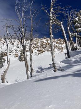
Snow depth is 1-2.5 feet in the mountains near Bozeman and Big Sky and 2-3.5 feet near West Yellowstone and Cooke City. Winter is off to a good start which means avalanches are possible.
Avalanches can be triggered where recent snow has drifted into thicker slabs, similar to avalanches earlier in the week that were 6-18” deep and triggered by skiers on Mt. Blackmore (photo) and in the Bridger Range (photo). Watch for signs of wind-loading and be cautious of steep slopes with drifts of snow. We have had many reports of a generally stable “right-side-up” snowpack below the recent new snow and drifts, but data is limited this early in the season and we can’t be too optimistic. Yesterday skiers near Beehive Basin found poor stability test scores and chose to ski lower angle terrain (view observation). Before committing to travel in avalanche terrain dig a quick snowpit, if you find signs of instability avoid steep slopes.
Whether you are in the mountains to ski, hunt, snowmobile, snowshoe, ice-climb or walk the dog: 1) Assess terrain where you plan to travel for avalanche potential. 2) Make sure you and your partner's avalanche rescue gear (beacon, shovel, and probe) is functional and you know how to use it. 3) If you plan to travel on steep slopes carefully assess the snowpack for unstable conditions.
Your observations are more important than ever this time of year as we get to know this season’s snowpack.
If you get out, please share avalanche, snowpack or weather observations via our website, email (mtavalanche@gmail.com), phone (406-587-6984), or Instagram (#gnfacobs).
Snow depth is 3-4 feet in the mountains near Island Park. Avalanches can be triggered where recent snow has drifted into thicker slabs. Watch for signs of wind-loading and be cautious of steep slopes with drifts of snow. Before committing to travel in avalanche terrain dig a quick snowpit, if you find signs of instability avoid steep slopes.
Upcoming Avalanche Education and Events
Our education calendar is full of awareness lectures and field courses. Check it out: Events and Education Calendar.
We are offering an Avalanche Fundamentals with Field Session course for skiers in December and January, and snowmobilers in early January. Sign up early before they fill up.
Friends of GNFAC Powder Blast Fundraiser
The Friends of the Avalanche Center are hosting the Powder Blast Fundraiser. Your donations support free and low-cost avalanche education, beacon checkers at trailheads, beacon parks, weather stations, and GNFAC programs! The Friends of GNFAC launched an online GoFundMe campaign. Please consider a donation, and we look forward to having an in-person event again in the future.


