Good Morning. This is Doug Chabot with the Gallatin National Forest Avalanche Advisory issued on the first day of spring, Tuesday, March 20th at 6:45 a.m. Today’s advisory is sponsored by Katabatic Brewing Company and Alpine Orthopedics. This advisory does not apply to operating ski areas.
It’s officially spring and winter’s grip is slowly loosening. Last night the mountains around Big Sky picked up 3” of snow with 2” falling in the southern ranges and 1” outside Cooke City. Another 1” of snow may fall in the southern ranges this morning. Under partly to mostly cloudy skies mountain temperatures are in the mid-teens with west wind at 15-30 mph. Sun will come out in the northern half of our advisory area and remain mostly cloudy in the south with temperatures rising to the high 30s.
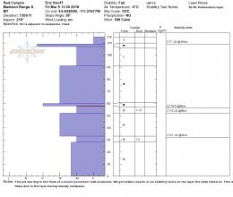
One to three inches of new snow will not adversely affect the snow stability. Winds are light to moderate from the west and wind loading will be minimal. Avalanches over the weekend broke within Friday’s new snow from a density change mid-storm. Both Eric in Beehive Basin and Alex in the Bridger Range reported this, especially on wind-loaded slopes (video, video). Since then it has strengthened and stabilized. I rode into Taylor Fork in the southern Madison Range yesterday and found good conditions: no signs of instability in the mountains or in my snowpit (video). Our snowpack lacks widespread weak layers and our avalanche concerns are limited to small pockets of wind-blown snow and cornices breaking off along ridgelines (photo).
Temperatures will rise above freezing in the northern mountains and possibly the south. Even a kiss of sunshine will dampen the snow surface and increase the chance of wet, loose avalanches. Clouds and light winds will keep the avalanche danger minimal if the weather forecast holds true. If skies become clear and sunny or temperatures break above 40F the wet snow avalanche danger would increase. Roller balls, pinwheels and wet sluffs of snow are signs of a weakening surface.
For today, throughout our advisory area, the dry snow avalanche danger is rated LOW. The wet snow avalanche danger is also rated LOW, but could rise to MODERATE if skies clear and temperatures warm more than expected.
If you get out and have any avalanche or snowpack observations to share, drop a line via our website, email (mtavalanche@gmail.com), phone (406-587-6984), or Instagram (#gnfacobs).
Send us your observations on Instagram! #gnfacobs
Posting your snowpack and avalanche observations on Instagram (#gnfacobs) is a great way to share information with us and everyone else this spring.
Upcoming Avalanche Education and Events
LIVINGSTON
TONIGHT! March 20, Beer for a Cause Night at Katabatic Brewing, Livingston, 4-8p.m. A dollar from every pint will be donated to The Friends of the Avalanche Center.
Brett French of the Billings Gazette wrote a great piece about the avalanche that caught a rider on 7 March on Kirkwood Ridge north of Hebgen Lake (article).


